
Gathering Waters is proud to offer sophisticated GIS tools to our members. We maintain a comprehensive database of all land trust holdings in Wisconsin and an easy to use interactive viewer, which members can use to see land trust holdings across the state.
We are now pleased to offer our land trust members a sophisticated “decision support tool,” which we introduced in a recent blog post. The tool can be used to identify potential conservation lands, to evaluate current holdings through robust conservation lenses such as The Nature Conservancy’s (TNC) Resilient and Connected Landscapes data, or simply to explore a wealth of conservation data organized for easy use.
Let’s take a look.
The statewide parcel map
The tool is driven by a customized version of what is called the “statewide parcel map.” It provides property and ownership information on the more than three million parcels that make up the state of Wisconsin.
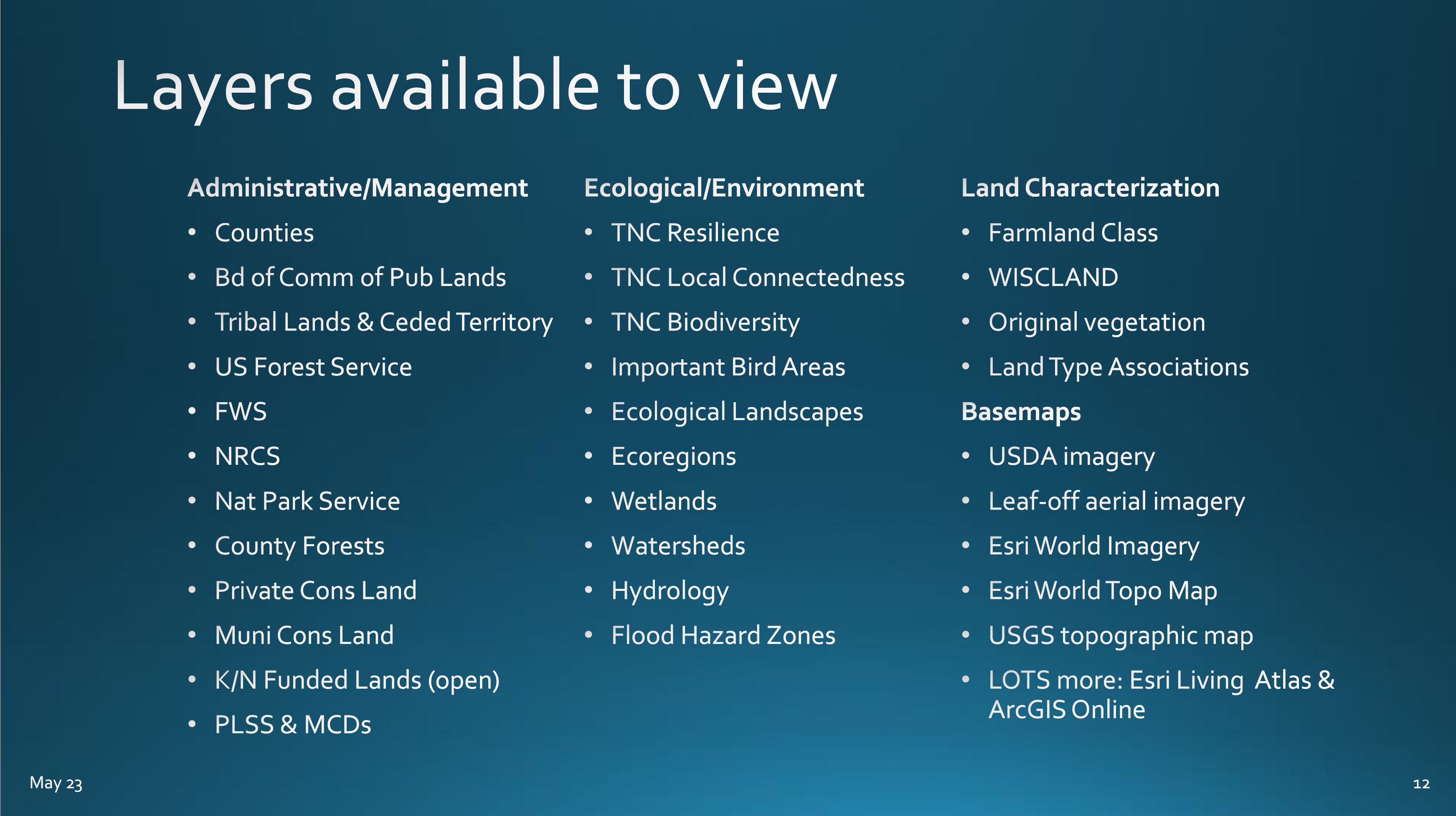
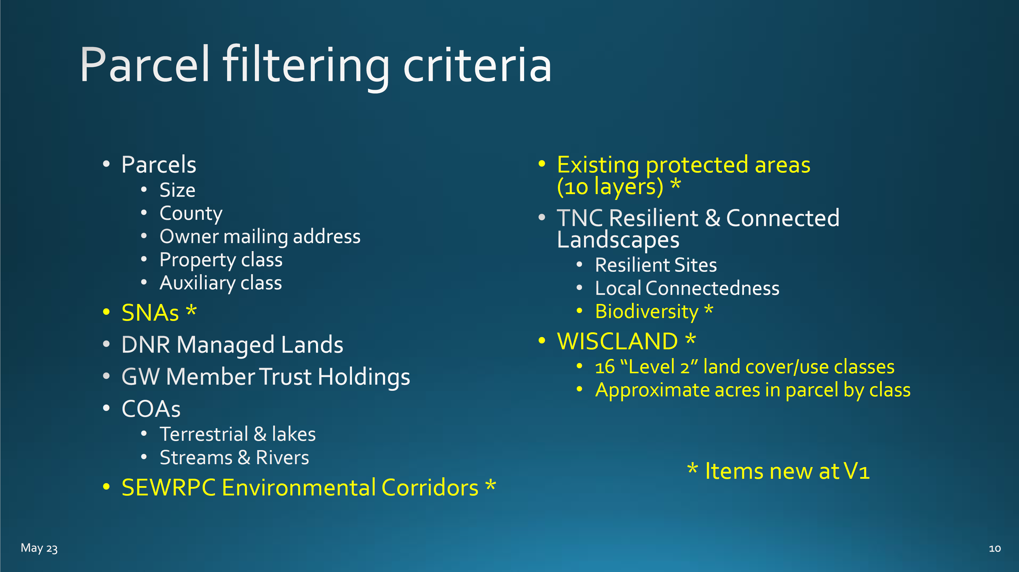
Gathering Waters has enriched that data by adding information such as:
- Land cover type (wetland, forest, grassland, etc)
- Resilience and Connectivity Scores from TNC
- Whether or not the parcel is adjacent to land that is already protected
- And lots more
We also removed more than two million parcels that are unlikely to be of interest to land trusts, including:
- Parcels smaller than 1 acre
- So-called “shared interest” parcels, such as condo communities where many owners own parcels of the same size that are “stacked” on top of one another
Removing all those parcels eliminates a lot of the “noise” that can make navigating the parcel map an overwhelming experience.

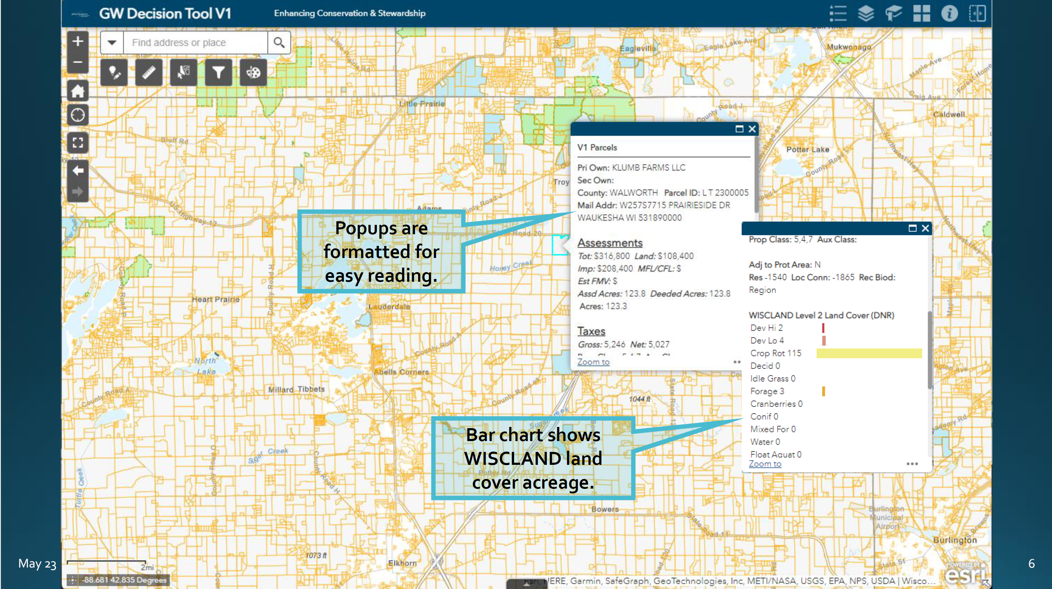
The information about individual parcels has been formatted for easy viewing. Here’s an example of the information one will find when clicking on any parcel included in the tool.
Sift and winnow
The real power of the decision support tool is its ability to quickly filter parcels based on more than two dozen criteria. Users can quickly zero in on parcels that are in their service area, meet minimum size requirements, and align with the organization’s goals (wetlands, high need communities, resilient lands, etc).
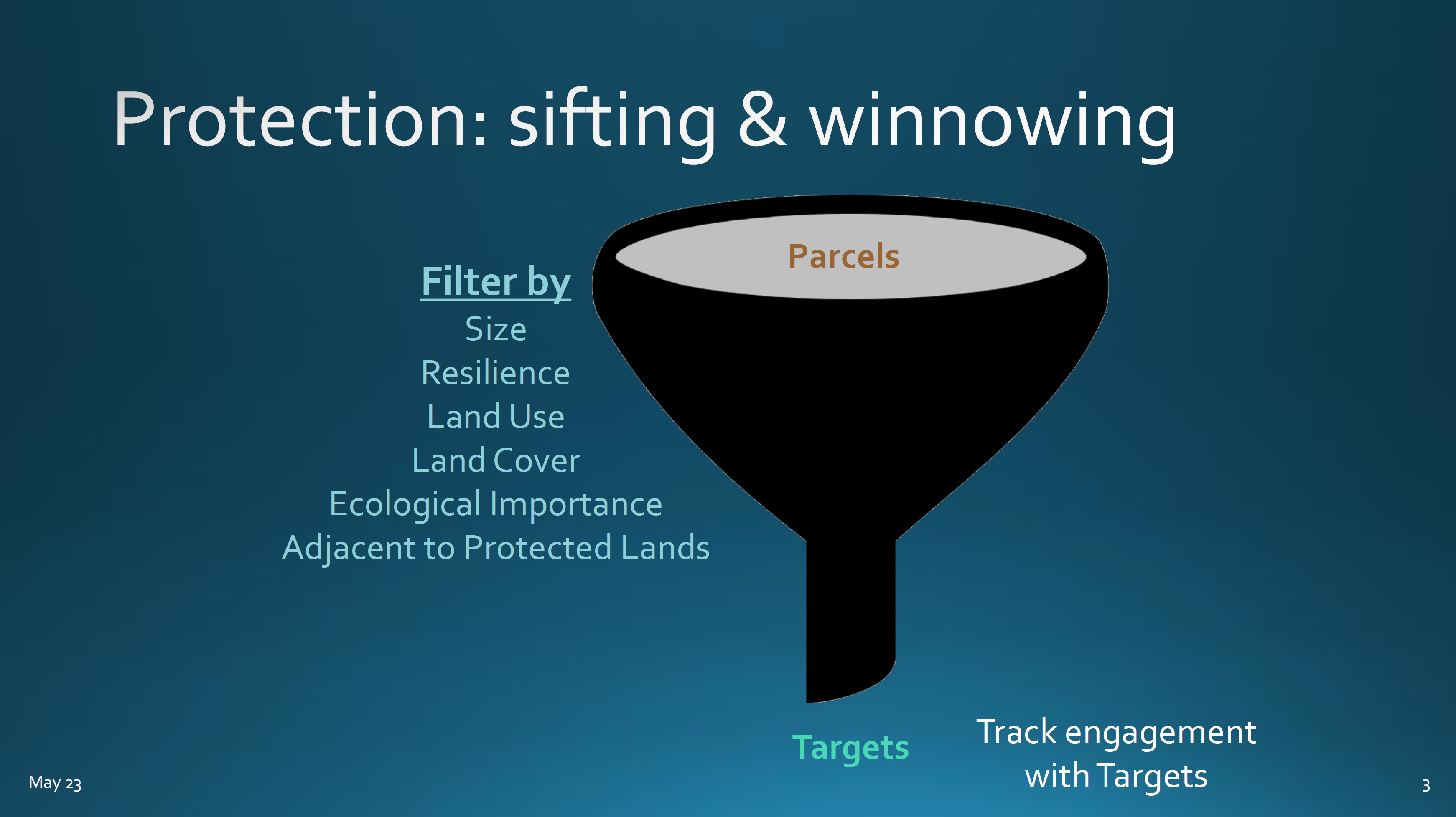
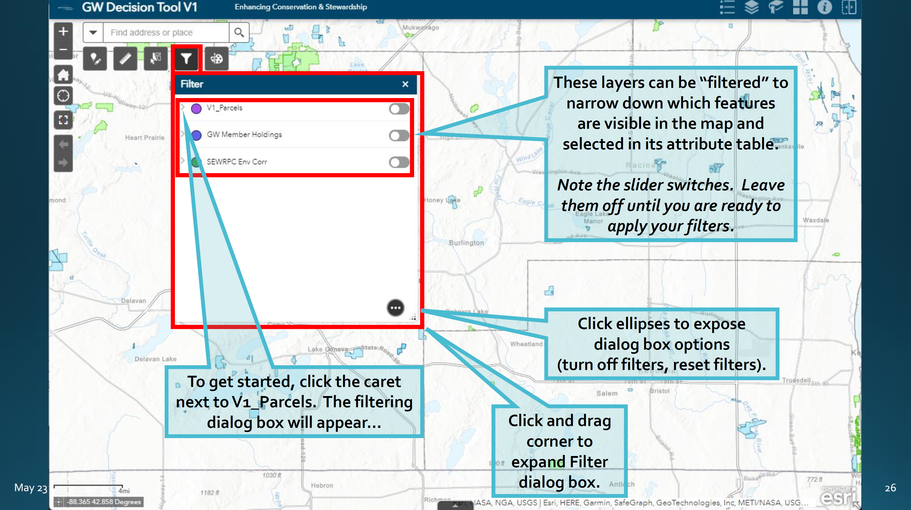
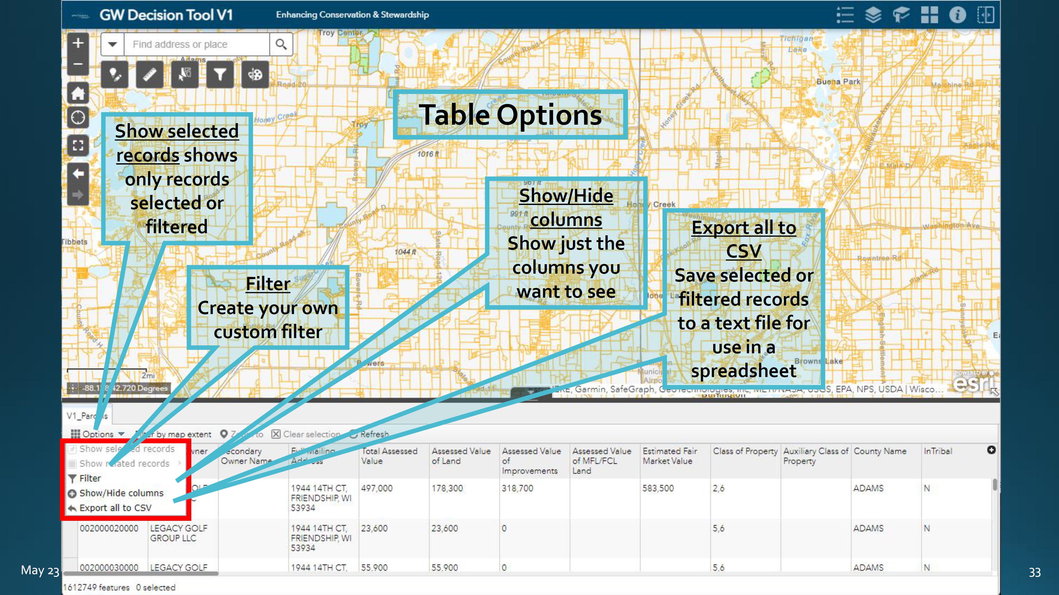
Detailed information about each parcel that has been identified through the filtering process can be viewed either by clicking on the parcel itself or in a table at the bottom of the screen.
Information in the table can be exported as a spreadsheet. This can be tremendously valuable to land trusts in outreach efforts. For example, a land trust may have funds to send out a mailer to 1,000 households. The map filters can help one quickly zero in on landowners who own high value conservation lands in order to educate them about opportunities to protect their land.
Try it out yourself!
The decision support tool is available to all Gathering Waters members. To access the tool, you need an ArcGis Online paid account. If you already have an account, email us with your username and we’ll give you permission to access the tool.
If you need an account, send us an email and we will set one up for you.
If you are already set up with GIS access through Gathering Waters, you’ll find the tool in the “Land Trust Member Files” group.
Finally, we are available for training.
Gathering Waters staff or board members can provide initial orientation to the tool or work with you on specific scenarios for your land trust. Email us and we’ll help you get started.